How VICS Works
VICS is a system that delivers road traffic information, including information on traffic congestion and traffic restrictions, to car navigation systems in real time via FM multiplex broadcasting and beacons.
 Where VICS Information Comes From
Road traffic information collected from prefectural police departments, road administrators, and vehicle probe data providers is processed and edited at the VICS Center and then provided to car navigation systems through three media.
Those three media are FM multiplex broadcasting, radio wave beacons (5.8 GHz) / ETC 2.0, and infrared beacons.

Additionally, the VICS information provided is displayed on car navigation screens using three methods: map display (level 3), simple graphics (level 2), and text (level 1).
The information displayed varies according to the media channel through which it is sent (FM multiplex broadcasting, radio wave beacons [ETC 2.0], or infrared beacons).
Three Media
-
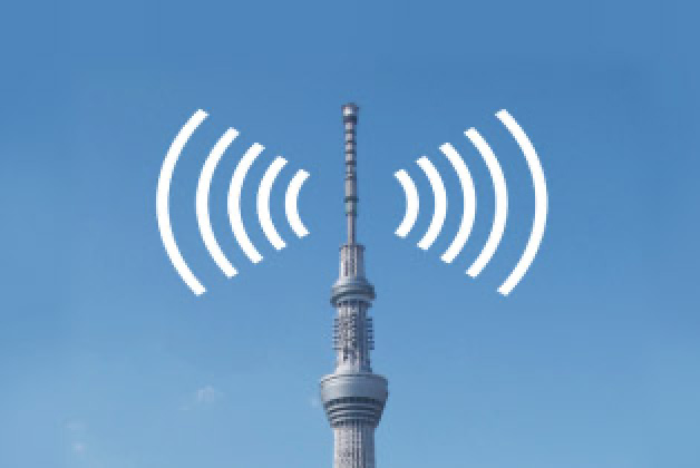
FM Multiplex Broadcasting
Road traffic information for the relevant prefecture and nearby regions is broadcast by local NHK FM broadcast stations.
Go here for detailsMain information provided
- Congestion information and travel time information
- Information on restrictions due to accidents, broken down vehicles, construction, natural disasters, weather conditions, etc.
- Information on parking lot location and parking space availability
Information provided by VICS WIDE
- Travel time information for multiple routes that reflect the latest congestion information
- Event-related traffic restriction information
- Emergency warnings due to weather and other conditions as well as heavy rain area information
-
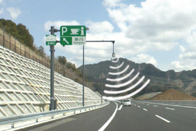
Radio Wave Beacons (5.8 GHz) / ETC 2.0
Primarily installed on expressways, this method provides information mainly related to the expressway ahead in the direction of travel, covering a distance of approximately 1,000 km.
Go here for detailsMain information provided
- Information on travel time between interchanges
- Congestion information and lane guidance at junctions (including parallel major ordinary roads)
- Information on restrictions related to accidents, broken down vehicles, natural disasters, weather conditions (road closures, lane restrictions, speed restrictions, snow chain requirements, etc.), etc.
-
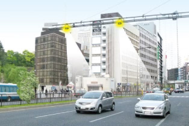
Infrared Beacons
These beacons, which are installed on major ordinary roads, provide traffic information for 30 km ahead of the vehicle and 1 km behind the vehicle.
Go here for detailsMain information provided
- Congestion information and travel time information
- Information on restrictions related to accidents, broken down vehicles, natural disasters, weather conditions (road closures, lane restrictions, speed restrictions, snow chain requirements, etc.), etc.
- Information on parking lot location and parking space availability
Support functionality provided by TSPS
- Signal passing support
- Signal stopping support
- Signal change starting support


| FM multiplex broadcasting | Radio wave beacons (5.8 GHz) / ETC 2.0 | Infrared beacons | |
|---|---|---|---|
| Provided by | VICS FM multiplex broadcasting | Radio beacons (on the road) | Infrared beacons (on the road) |
| Where it can be received | Within the broadcast area | Mainly on the expressway | Mainly on ordinary roads |
| Frequency / wavelength | 76–90 MHz | 5.8 GHz | N/a |
| Data capacity | 50 KB (100 KB per 5 minutes) | 25 KB | 10 KB |
| Transmission speed | 16 Kbps | 4 Mbps | 1 Mbps downlink / 64 Kbps uplink |
| Communication range | 10–50 km | 20 m | 3.5 m |
| Information provision frequency | 2 times per 5 minutes | 2–3 times per transmission | N/a |
| Effective information volume | Approx. 50,000 characters equivalent per 5 minutes | Approx. 25,000 characters equivalent per location | Approx. 10,000 characters equivalent per location |
| Information content |
|
|
|
|
Level 3 map display |
Traffic congestion information, link travel time (expressway information), zone travel time information, incident-related restriction information, parking lot information | Traffic congestion information, link travel time (expressways only), zone travel time information, incident-related restriction information, service area / parking area information | Traffic congestion information, link travel time, zone travel time information, incident-related restriction information, parking lot information |
|
Level 2 simple graphics display |
Traffic congestion information, zone travel time information, incident-related restriction information | Traffic congestion information, zone travel time information, incident-related restriction information, service area / parking area information | Traffic congestion information, zone travel time information, incident-related restriction information, parking lot information |
|
Level 1 text display |
Traffic congestion information, zone travel time information, incident-related restriction information | Zone travel time information, incident-related restriction information, service area / parking area information | Traffic congestion information, zone travel time information, incident-related restriction information, message information |